
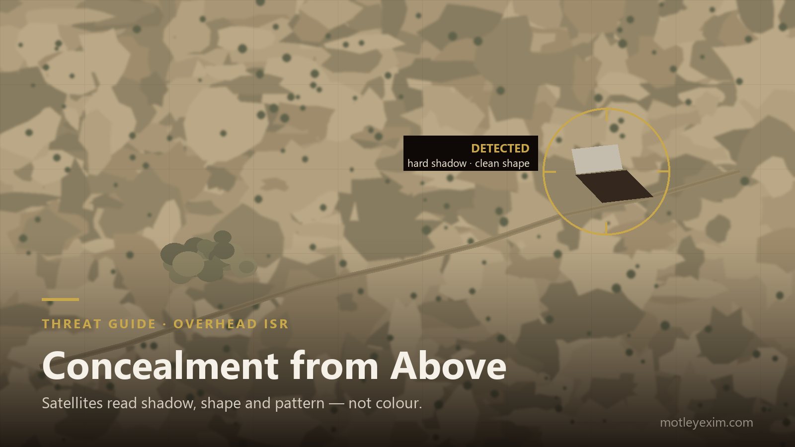
Most camouflage thinking starts at eye level — an observer on the ground, a silhouette against a background. But the view that increasingly decides whether a position survives is the one from directly above: satellites on predictable revisit schedules, reconnaissance aircraft, and drones that photograph a site in plan view. Overhead imagery does not see silhouettes at all. It sees shadow, shape, pattern and geometry — and it punishes a different set of mistakes. This guide covers what actually changes when the sensor looks straight down, and what to specify against it.
TL;DR
- From above there is no silhouette — the giveaways are shadow, plan-view shape, tracks and regularity, roughly in that order.
- A hard cast shadow survives even when colour and pattern are perfect — edge treatment and standoff matter as much as the cover itself.
- Fine disruptive patterns average out into a uniform blob at imaging resolution; overhead concealment needs bold, large-scale disruption and irregular edges.
- SAR satellites image in radar, day and night, through cloud — colour is irrelevant to them; the radar band needs its own answer (attenuating or transparent).
- Commercial constellations mean overhead observation is persistent and widely available — it is a baseline threat now, not a special case.
The overhead view is a different problem
Ground-level camouflage is built around the silhouette: break the outline, match the background, kill the shine, and an observer looking horizontally struggles to separate the asset from what is behind it. Directly overhead, that entire logic goes quiet. There is no background behind the asset — the asset is the background’s interruption. The sensor sees a plan view: roof surfaces, top decks, the layout of a site, and the ground immediately around it.
That changes what gives a position away. In overhead imagery the reliable cues are shadow, plan-view shape, the tracks that lead to a position, and the tell-tale regularity of anything laid out by an organisation rather than by nature. A cover that solves the eye-level problem while ignoring these will photograph beautifully from a hillside and fail completely from altitude. The principles of multi-spectral concealment still apply — but they have to be applied to a different geometry.
What is actually looking down
Three families of overhead sensor matter, and they fail differently. Electro-optical imaging — from satellites and aircraft — produces the familiar photographic view, at resolutions now sharp enough to classify vehicles by type. Crucially, this capability is no longer scarce: commercial constellations sell high-resolution tasking to almost anyone, with revisit rates that keep shortening. Synthetic-aperture radar (SAR) images in the radar band, day or night, through cloud and haze; it responds to geometry, orientation and conductivity, which is why a metal vehicle can dominate a SAR frame while remaining modest in an optical one. And thermal sensors on aircraft and drones read emitted heat on night passes, when optical imagery gives nothing.
The practical conclusion is uncomfortable but clarifying: overhead observation has to be assumed to be persistent, multi-band and available to a wide range of actors. Concealment from above is a baseline requirement now — the same shift that cheap thermal drones forced at low altitude, covered in our anti-drone concealment guide, has happened at orbital altitude too.
Shadow is the stubborn giveaway
Colour can be matched and pattern can be tuned, but a hard cast shadow survives both. A vehicle under a taut, sharply edged cover still throws a crisp dark rectangle on the ground beside it — and in overhead imagery that shadow is often easier to detect than the object itself, because it is high-contrast, geometric and points the same way as every other shadow in the frame.
Managing it is mostly a matter of physical form. A cover needs enough footprint and overhang to feather down to the ground rather than presenting a vertical face; edges should be broken and irregular rather than taut lines; and siting should use existing shadow — treelines, walls, terrain relief — so the position’s own shadow disappears into clutter that was already there. None of this costs performance in any other band, which is why shadow discipline is the cheapest overhead win available.
Pattern scale and imaging resolution
A disruptive pattern works by giving the sensor several distinct shapes to resolve instead of one continuous object. That only works if the sensor can actually resolve the elements. From altitude, fine pattern detail falls below the resolution of the imagery and averages out — the cover photographs as a single, suspiciously even tone, and its neat outline does the rest.
Overhead-effective camouflage therefore uses bold, large-scale disruption: pattern elements sized so they still read as separate patches at the resolutions the site will realistically be imaged at, irregular perimeters instead of rectangles, and tonal variation matched to how the surrounding terrain actually looks in plan view — which is often quite unlike how it looks from the ground. This is also why garnished, three-dimensional surfaces age better from above than printed flat sheets: they produce real texture and internal micro-shadow instead of a uniform printed field.
The radar view from orbit
SAR deserves its own paragraph because it ignores almost everything visual camouflage does. It does not care about colour, pattern or paint tone; it responds to shape, size, orientation and conductivity. Flat metal surfaces and right angles return strongly, which is why vehicles, containers and shelters stand out in radar imagery even at night and under cloud.
Managing that return is its own engineering problem — radar-attenuating netting and radar-absorbent coatings for assets whose return must come down, and deliberately radar-transparent covers for positions that transmit, so their own radar and communications are not degraded by their concealment. Which of the two is correct is a property of the asset, not of the net, and it belongs in the requirement explicitly. Our explainer on radar cross-section and its reduction covers the underlying mechanics.
Tracks, spacing and the pattern of life
Overhead analysts are trained to read the ground, not just the objects on it. Vehicles wear converging tracks into soil within days, and those tracks point at a concealed position as clearly as a signpost. Equally spaced, similar-sized objects read as military even when each one is individually well covered, because nature does not arrange things in rows. And repeated activity — the same routes, the same timings — builds a pattern of life that survives any amount of netting.
These are matters of practice rather than product, and they are covered at the doctrinal level in our note on camouflage and concealment doctrine. The reason to raise them in a specification context is simple: a buyer who invests in a capable multi-spectral cover and then ignores approach discipline has bought concealment and installed a signpost next to it.
What to specify for the overhead threat
An overhead-aware camouflage requirement should state:
- Full-footprint coverage with overhang — the cover must extend beyond the asset and reach the ground, not merely drape its top surface.
- Edge and shadow treatment — broken, feathered perimeters and enough standoff that the cover does not cast its own crisp shadow.
- Pattern scale for plan-view imaging — bold disruption that survives resolution averaging, with tone matched to the terrain as it appears from above.
- A stated radar-band position — attenuating for assets whose return must come down, transparent for positions that transmit.
- Thermal behaviour for night passes — emissivity management and decoupling from the warm asset, as covered in our note on emissivity in thermal camouflage.
- Aged performance, verified — measured at an accredited laboratory against stated methods, because a cover that only performs when new fails quietly in service.
Specified that way, the cover addresses the sensors that will actually image the site. For the wider process, see how to specify a multispectral camouflage net.
Frequently Asked Questions
Can a camouflage net hide an asset from satellites?
No single measure makes an asset invisible from orbit — and any supplier claiming that should be treated with caution. What a properly engineered multi-spectral cover does is reduce detectability and, above all, recognisability: the exposed shape, the hard shadow and the strong sensor return that make an overhead analyst’s job easy. Concealment from above is always layered — cover, shadow management, siting and site discipline together.
What actually gives a position away in overhead imagery?
Four things, usually in this order: shadow, because a hard cast shadow survives even when colour matches; plan-view shape, the rectangles and circles nature does not produce; tracks, which converge on a position like a signpost; and regularity — evenly spaced, similar-sized objects read as military even when each one is individually well concealed.
Does a camouflage net work against SAR satellites?
Standard visual netting does very little against synthetic-aperture radar, because SAR responds to geometry and conductivity rather than colour. Reducing a radar return needs radar-attenuating netting or radar-absorbent coatings; positions that transmit need the opposite — a radar-transparent design. Which is correct depends on the asset, so the radar band must be stated in the requirement, not assumed.
Why does pattern scale matter from altitude?
A disruptive pattern works by breaking an outline into shapes the sensor resolves individually. From long range, fine pattern elements fall below the imagery’s resolution and average into one uniform tone — a neat, evenly coloured blob against a varied background. Overhead concealment needs bold, large-scale disruption and irregular edges, matched to how the site will actually be imaged.
Do commercial imaging satellites change the threat picture?
Fundamentally. High-resolution optical and radar imagery can now be tasked commercially by almost any customer, with steadily improving revisit rates. Overhead observation must therefore be assumed to be persistent and widely available — concealment from above is a baseline requirement now, not a special case.
What should an overhead-concealment specification include?
Full-footprint coverage with overhang; edge treatment and standoff so the cover feathers into the ground instead of casting its own shadow; pattern scale appropriate to overhead imaging; a stated radar-band position (attenuating or transparent); thermal behaviour for night passes; and performance verified after ageing at an accredited laboratory.
Procurement or technical question?
CAMPRO® camouflage, CAM-IRR® paint, fire-suppression systems, and export-compliance support. Our team replies within one business day.
Contact Our Team →